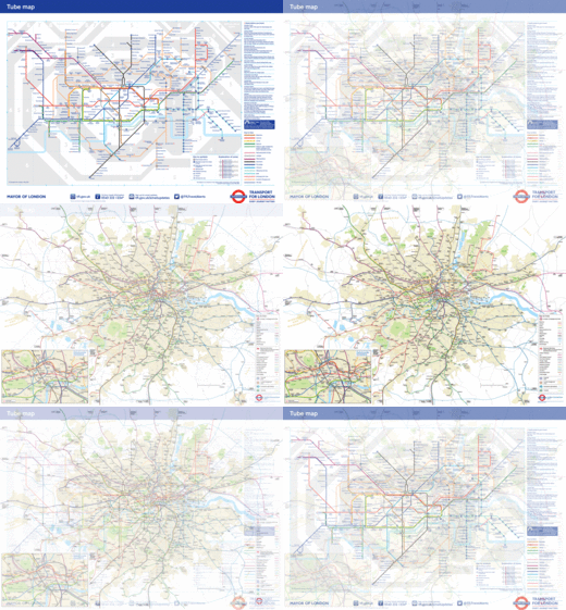
Colorfully laid out according to the clean, minimalist principles of electric diagrams, Henry Beck's map for the London Underground is unquestionably a design classic; one that has been updated—but never fundamentally changed—for over 80 years. The problem is, great as it may be, it's not geographically accurate. (A fact that causes up to 30% of London travelers to choose the wrong route, and occasionally inspired designers to think they can do better by "rounding the circle" of Beck's Tube diagram into a proper map.)

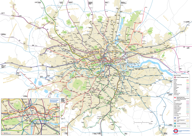
It turns out, though, that the London Underground has secretly maintained an easily understood, geographically accurate map of its tube routes for years. And now, thanks to a Freedom of Information Request filed by James Burbage in 2014, it looks like this more accurate Underground map will be made available to everyone.
It's called the Geographical London Connections map, and it was last updated by Transport for London (TFL) in May 2014 for internal use. The map is incredibly easy to read, clearly overlaying the Underground's routes and gridlines over London's neighborhoods, river, wharfs, and parks. It keeps a lot of the official tube map's colors and iconography, so it sort of looks like the Beck Map was stretched and distorted over a proper street map of London.

When Burbage filed his request, he politely asked: "Please supply a geographically accurate map of all the stations, platforms, lines and tracks that form the London Underground, London Overground, Docklands Light Railway and National Rail services where applicable, which is updated as of August/September 2014. Omit information which could pose a concern for health and safety." A month later—which is a shocking turn around time compared to how long it takes for an FOIA request to be processed in America—the TFL was happy to oblige.
But the story doesn't end there. According to Citymetric, response to the London Connections map has been so positive that the TFL has decided to keep an updated version published on their website. "This map was produced for engineering works planning and wasn't designed for customer use, however we are happy to make any maps available which help our customers to travel in London, wrote Gareth Powell, director of strategy & service development at London Underground. "This map will therefore be added to our website."
Now, travelers on the Tube will be able to have the best of both worlds: Beck's classic diagram, and an accurate map to consult when that diagram is confusing. You can explore the full London Connections map here.