Clambering in the back of a van or station wagon and driving with your folks to your nearest national park used to be a summer tradition. Certainly, it was for Matt Holly, who grew up to be a national park's ranger. "I come from a family that loved visiting national parks," he says. "There was just something about driving through that park entrance and having the ranger hand you a map. You made it. You're here now. Let's have some fun."
Holly's obsession with National Park Services (NPS) maps is why he set up NPMaps, a website that serves as a resource for high-resolution downloads of all the national parks maps he can find, as Citylab recently pointed out. The official map for every national park is designed at Harpers Ferry Center according to the agency's Unigrid guidelines, which were created by no lesser designer than the legendary Massimo Vignelli. But those aren't the ones Holly's really fascinated with: It's the regional maps created by the local rangers themselves, with highly specific goals unique to their parks.
We asked Holly to share some of his favorite National Park Services maps, along with his favorite design details. Here's what he said about them.
Death Valley Map (California)

"One feature I particularly enjoy on some of the newer maps is the use of a mask to highlight the park area compared to the surrounding terrain. Notice how in the Death Valley map, it shows the topography both inside and outside the park, yet the park is still easy to distinguish and really jumps off the page. This is a great example of realistic coloring."
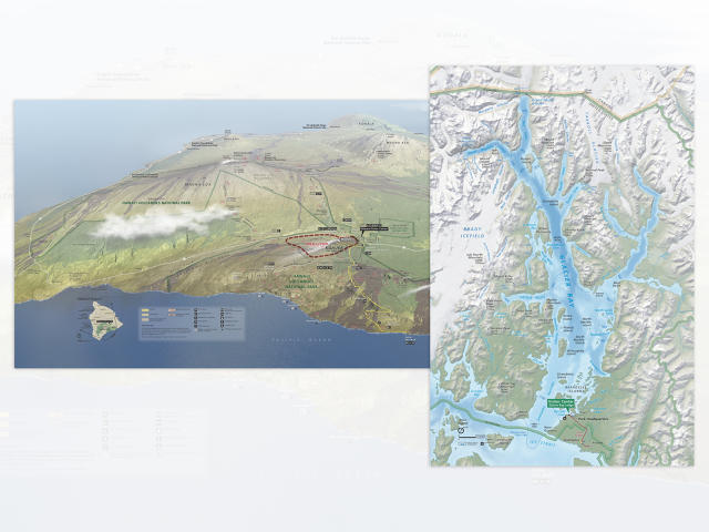
Hawaii Volcanoes and Glacier Bay Maps

"Note how Hawaii Volcanoes labels historic lava flows with dates; Glacier Bay includes dates showing the past extent of the park's glaciers. These small details add a lot—Hawaii now seems much more alive, with new lava flows occurring all the time, and Glacier Bay helps us learn how climate change is impacting our parks."
The Haleakala Exhibit Map (Hawaii)

"Just as Hawaii Volcanoes does a great job of showing the context around the park and showing how the park fits into the larger island landscape, this Haleakala exhibit map is one of my favorites. Different maps have different purposes; clearly this map is not meant to help visitors navigate around the park, but instead shows visitors the geography and geology of Maui and how the park fits into the landscape. This is much more effective than a simple top-down outline for teaching visitors about Maui."
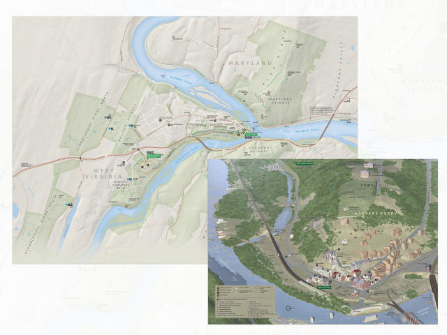
Harpers Ferry National Historical Park Maps (West Virginia)

"It's not just big natural parks that get the love; take a look at the set of maps included in the Harpers Ferry National Historical Park brochure. First, the zoomed-out view shows the entire extent of park lands and the surrounding topography, and the Lower Town map identifies and labels the park's historic structures. Anyone can read and navigate this map even if they've never read a map before."
The Great Sand Dunes (Colorado) and White Sands (New Mexico) Maps

"A couple other personal favorites include some sand dune parks, Great Sand Dunes and White Sands. What do visitors always want to know when visiting these parks? 'Why is there all this sand here?' Both maps include simplified diagrams drawn onto the landscape to show how wind and water interact to help form the dunes. And in both maps, realistic colors and topography make it much easier for visitors to orient themselves compared to using a flat monochrome map."
The Kenai Fjords Map (Alaska)

"The Kenai Fjords map is one of the best in terms of evoking personal wonder and excitement in me. Most visitors to the park just go to Exit Glacier—the only road-accessible location from Seward. "But look at that map! Look how much more of the park there is to see! Look at all that ice and all those fjords! And are those campsites out there on the water? How do I get there? I want to go to there." Exit Glacier is pretty awe-inspiring from a personal visit, but a look at this map shows how tiny Exit Glacier is compared to the rest of the park."
Dry Tortugas Map (Florida)

"I'd be remiss if I didn't share this map with you, simply because of that beautiful blue color!"
More of Matt Holly's National Parks Services Maps can be found here.
[Cover Photo: Daniel Burka via Unsplash]